

Introduction to RTLS
17 July 2026In today’s industry, knowing where has become just as critical as knowing what or how. Real-Time Location Systems (RTLS) provide precise, real-time location data for assets, people, and materials, enabling businesses to streamline processes, enhance safety, and reduce downtime.
But RTLS isn’t just theory. This guide is built on hands-on experience implementing these systems in complex industrial environments, where we’ve seen firsthand what works, what doesn’t, and how to generate measurable value.
A technology with deeper roots than you’d expect
RTLS may feel like cutting-edge technology, but its origins go back to World War II, when the military developed the Identification Friend or Foe (IFF) system to distinguish allied aircraft from enemies using radio signals, an early proof of concept for wireless tracking.
The term “RTLS” itself was coined in 1998, though early systems were expensive and limited in range. The real turning point came with Bluetooth Low Energy (BLE) in 2010 and the rise of Ultra-Wideband (UWB), which together made continuous, long-range, precise tracking practical and accessible for industrial use.
What began as a wartime innovation is now a core tool for logistics, manufacturing, healthcare, and beyond.

How a RTLS (Real Time Location System) works

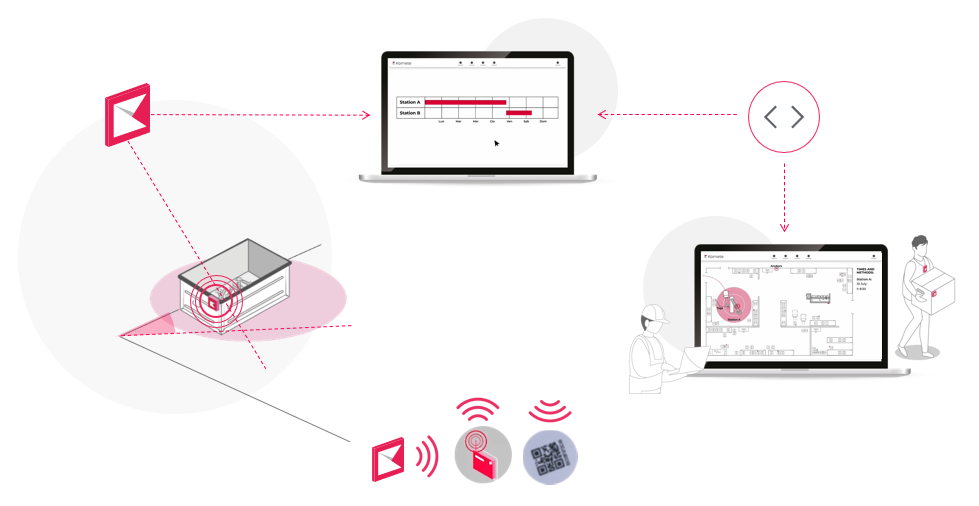
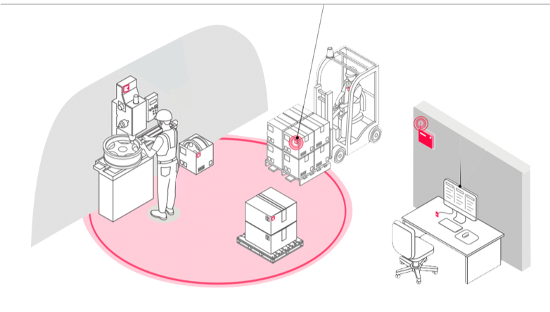
A modern RTLS system works on the same principle as the GPS on your smartphone, but designed for indoor environments like factories, warehouses, and hospitals, where satellite signals don’t reach.
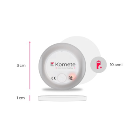
Asset tags are small devices, roughly the size of a two-euro coin, attached to the objects you want to track. Equipped with a chip and battery, some models last over 10 years and transmit signals up to 200 meters. Many also include sensors for temperature, humidity, or movement.
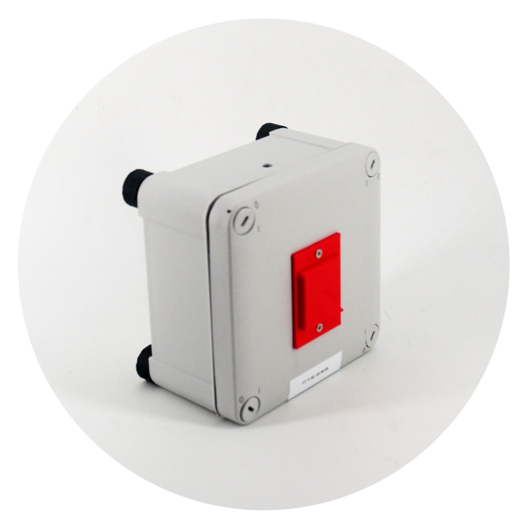
Antennas are installed at fixed points throughout the facility. They receive signals from the tags and pass that data to the positioning system, just like satellites do for GPS.
The positioning system processes that data to calculate each asset’s exact location, using methods ranging from basic signal strength (RSSI) to more advanced techniques like triangulation or Time of Flight (ToF). It can run on a local server or in the cloud.
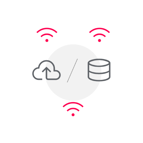
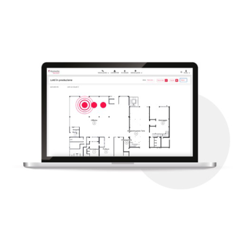
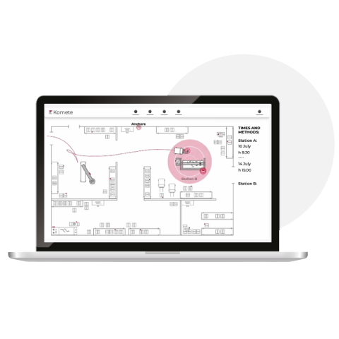
The software is where everything becomes visible, assets shown on a live map, time spent in each zone, heat maps, spaghetti charts, and more. It’s the layer that turns raw location data into actionable decisions.
With the RTLS software, you can:
- Track the position of assets on a live map
- Monitor crossing times through various areas for each asset
- Analyze data using advanced visual tools like heat maps or spaghetti charts
Example 1: Tracking a Box with a Work Order in a Factory
Imagine a box carrying parts or materials that need to move through different workstations in a factory. Using RTLS makes it easy to track its journey automatically, step by step.
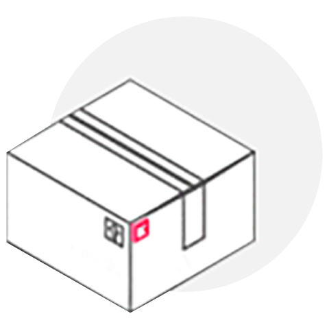
1. Tagging the Box
A worker attaches a small electronic tag to the box and scans its barcode, linking it to the relevant work order in the system.
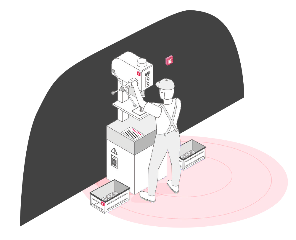
2. First Workstation
When the box arrives, the antennas in the area detect the tag automatically. The system logs the arrival and starts tracking how long the box stays there.
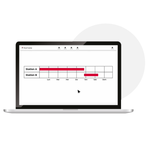
3. Moving to the Next Stationto alla stazione successiva
As the box moves to the next station, the system updates its position in real time, stopping one timer, starting the next. This continues automatically through the entire production line.
4. Automatic Tracking
This process continues automatically as the box moves through the production line. The RTLS software displays the box’s real-time location on a map and records the time it spends at each workstation.
In a traditional setup, updating a work order depends on manual inputs, data entered by operators at the end of a shift, or not at all. Often it happens late, sometimes it doesn’t happen, and almost never reflects what’s actually moving through the line in real time. RTLS eliminates this gap entirely: the system updates automatically at every step, without requiring any action from the operator. Managers always know where each order or semi-finished product is, how long it’s been there, and whether it’s on schedule.
Different Levels of Location Precision in RTLS
Real-Time Location Systems (RTLS) provide different levels of detail depending on the precision required:
Presence Detection
Indicates whether an object or person is within a specific area, like confirming if something is inside a building or room, without specifying exactly where.
Zone Tracking
Identifies the general section or zone within an area where an object or person is located, such as a specific part of a warehouse or facility.
Precise Positioning
Pinpoints the exact location of an object or person within an area, down to a very specific spot, allowing for detailed tracking of movement or placement.
These levels of granularity allow RTLS to adapt to different scenarios, from broad presence awareness to highly detailed location data.

Dove l’RTLS fa la differenza
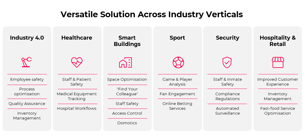
L’RTLS è utilizzato in un’ampia gamma di settori e applicazioni: tracciamento di utensili e attrezzature per evitare smarrimenti, monitoraggio degli ordini in lavorazione lungo la produzione, gestione automatica dell’inventario, sicurezza dei lavoratori in ambienti pericolosi, e controllo di condizioni come temperatura o umidità per merci sensibili.
Nella manifattura e nella logistica è più diffuso, eliminando il tracciamento manuale, riducendo i tempi di ricerca e offrendo ai responsabili visibilità in tempo reale su asset e flussi di lavoro. Ma la stessa tecnologia è usata per il tracciamento dei giocatori nello sport professionistico, la gestione delle attrezzature negli ospedali e l’analisi del flusso clienti nel retail.
Benefits that show up on the bottom line
| Less time wasted searching | In manufacturing and logistics, operators routinely lose time hunting for tools, materials, or equipment. RTLS locates any asset instantly, freeing staff for higher-value work and reducing lead times directly. |
| Inventory that updates itself | No more manual counts or misplaced items. Materials and assets are tracked automatically as they move, so stock levels are always accurate and delays from missing components are eliminated. |
| Objective data on processes | RTLS replaces pen-and-paper records and operator memory with clean, automatic data on where things are and how long each step takes. A reliable baseline to improve workflows and make decisions based on facts, not estimates. |
| Worker safety | In hazardous environments, knowing where every worker is at all times allows for faster emergency response and accident prevention, reducing both human risk and operational liability. |
| Hidden inefficiencies made visible | If a work order is sitting at a station longer than it should, the system flags it. Bottlenecks that were previously invisible, or only discovered days later, become immediately actionable. |
| Indirect Benefits | The impact of RTLS goes beyond the obvious. Faster processes mean better customer satisfaction and quicker deliveries. Safer environments improve worker morale and reduce turnover. Cleaner data leads to smarter automation, unlocking long-term value and competitiveness. |
Technologies
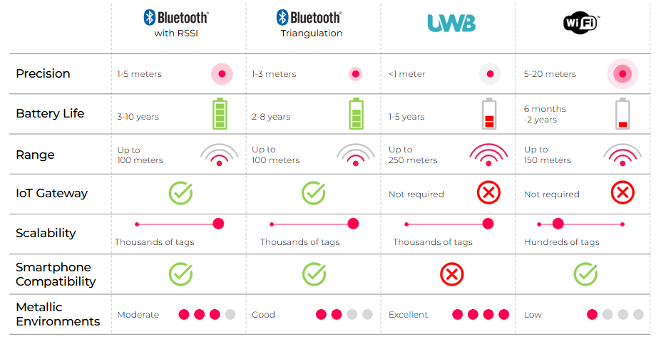
Not all RTLS technologies are equal. They differ in precision, battery life, infrastructure cost, and how well they perform in industrial environments with metal and machinery.
BLE (Bluetooth Low Energy) is the most widely adopted choice: cost-effective, with battery life up to 10 years and precision between 1 and 5 meters depending on the method used. It handles metallic environments reasonably well with proper antenna placement.
UWB (Ultra-Wideband) is the go-to when precision matters most, delivering accuracy below 1 meter. It requires more infrastructure investment but is highly resistant to interference, making it ideal for complex industrial layouts.
Wi-Fi is an option where existing network infrastructure can be reused, keeping initial costs low. Precision is similar to basic BLE (3-5 meters), but battery life is shorter and performance in metal-heavy environments is limited.
This guide focuses on active RTLS technologies only. Unlike passive systems like RFID tags – which only identify an object when it physically passes in front of a reader – active RTLS tracks assets continuously and in real time, without requiring any manual action. A fundamentally different approach, which deserves a dedicated comparison.
A few things to keep in mind
RTLS implementation comes with real challenges: metallic environments can affect signal performance, high precision requires more infrastructure investment, and tracking workers raises privacy questions that need to be addressed transparently with employees and in line with local regulations.
The most common mistake is chasing maximum precision when the actual objective doesn’t require it. Before selecting a technology, it’s worth considering:
- what specific problem you’re trying to solve
- how much precision your use case actually needs
- the environmental conditions of your facility (metal, layout, size)
- privacy and compliance requirements for worker tracking
- whether to start with a small pilot before scaling
Choosing the right technology means matching it to your goals first, and your budget second.
How we approach it at Komete
Our focus is on practical deployments that match the real needs of each environment, without over-engineering. In most cases we use hybrid setups, combining different technologies to balance precision, cost and resilience, especially in complex industrial settings where no single technology covers everything perfectly. The goal is always a system that works reliably from day one and can scale as needs evolve.